The planetary boundary layer height (PBLH) is an essential component of modeling pollutant transport and weather prediction algorithms. Accurate values are imperative to successfully predict pollutant levels, such as particulate matter PM, and alert the population on time of harmful levels. This project will focus on getting the most accurate PBLH using LiDAR data. The lidar's carrier-to-noise (CNR) values are used for the calculations. The vertical wind velocity is also being used to determine the PBLH values.
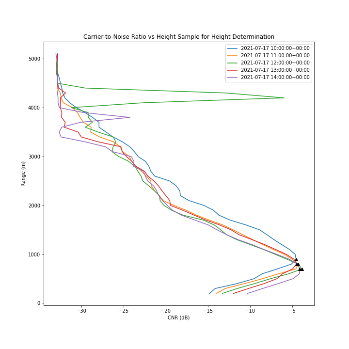
Angevine et al. method used the median of the SNR to calculate the height of the Convective Boundary Layer (CBL), which is the boundary layer that increases during the day. This was possible thanks to the proportionality of the refractive index and SNR theorized by Ottersten et al. (1969). The author also mentions using the median for the calculation but suggests carefulness as the BLH might be over-estimated. The median is used by the authors to avoid any outliers from the data. The work performed by the researchers was done on wind profilers. The algorithm used for this project used the same Springer Nature 2021 LATEX template PBLH Comparisons 3 method. First, the data was sampled over 30 minutes. Then the sample median over those 30 minutes was computed at every range. Then height was picked at the field in which the CNR median was maximum. Fig. 2 CNR algorithm illustration. The height is determined at the range where the CNR the median is the maximum.
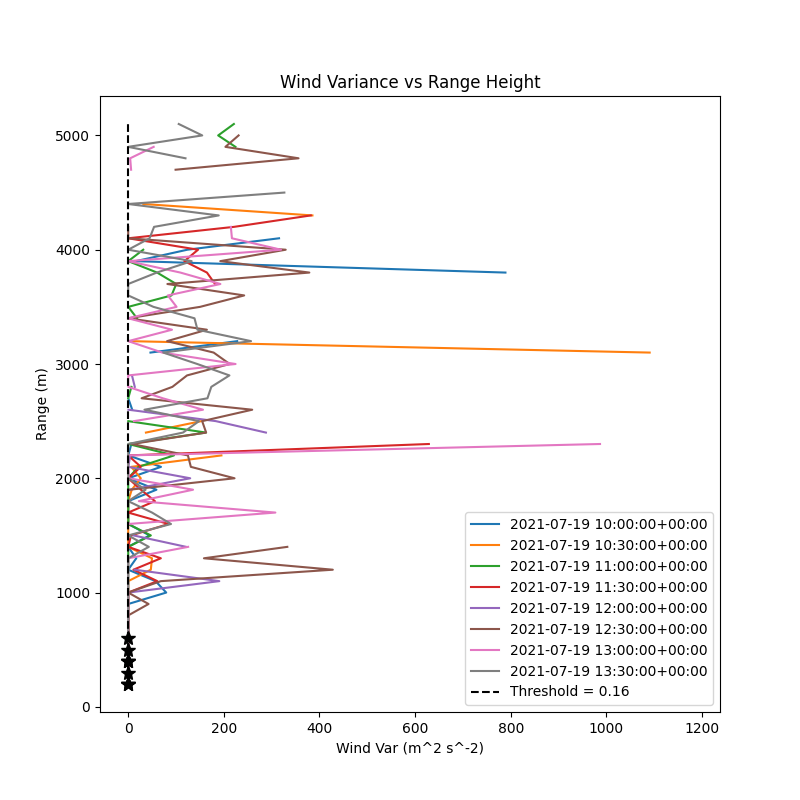
The wind variable is also used to determine the boundary height. The algorithm is based on Moreira et al. (2018). In their work, the researchers use a microwave radiometer, elastic LiDAR, and Doppler LiDAR to determine the
PBLH. The vertical wind speed method is the one being tested here. In their
work, the vertical wind speed is determined at the first height where the vari-
ance is lower than a predetermined threshold. The threshold the research is
using is 0.16 m2/s2. This value, they cited, has been astoundingly used and
proven reliable. This is the value that is being used during the application of the
algorithm with the LiDAR data. X et al. used a threshold value of 0.1 and
argued that this value had been successfully applied to other calculations in
metropolitan cities such as England. The second threshold was also plotted
for comparison
The wind variable is also used to determine the boundary height. The algorithm is based on Moreira et al. (2018). The researchers used a microwave radiometer, elastic LiDAR, and Doppler LiDAR to determine the PBLH. The vertical wind speed method is the one being tested here. Their work determines the sheer wind speed at the first height where the variance is lower than a predetermined threshold. The threshold the research is using is 0.16 m2/s2. This value, they cited, has been astoundingly used and proven reliable. This is the value that is being used during the application of the algorithm with the LiDAR data. X et al. used a threshold value of 0.1 and argued that this value had been successfully applied to other calculations in metropolitan cities such as England. The second threshold was also plotted for comparison.